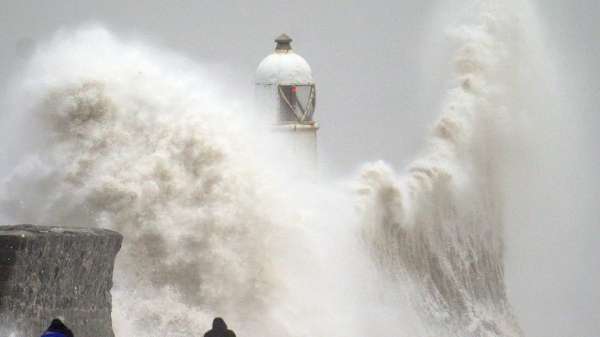
Storm Darragh is the first storm since last January’s Isha to earn a red “threat to life” warning from the Met Office.
And it has lived up to that dubious honour.
The highest recorded windspeed was 96mph (154kph) in Berry Head, Devon, and two people have died as a result of the storm.
Get the five-day forecast where you are

While Darragh wasn’t the most intense storm in recent years, it was a monster. The extra-tropical cyclone (to give it it’s proper title) measured 1,000km (621 miles) across as it passed right over the UK.
Revolving anti-clockwise, as such storms do, it encircled our coasts with winds from the north and east with the most powerful barrelling in from the southwest.
It’s just over two weeks since Storm Bert brought widespread flooding and high winds to Wales and southern England with four named storms now in the last three months.
So, it’s not unreasonable to ask: Is the UK getting stormier?

The 2023/24 storm season was certainly a bad one with 12 named storms. The Met Office got so far down the alphabet the season ended with Lilian’s yellow warnings for rain and wind in August.
But the season before saw just two named storms. You have to go back to 2015/16, when there were 11 named storms.
The picture is messier before that date as the naming convention began in 2015, making comparisons before then impossible.

However, meteorologists believe the 2013/14 storm season was the most severe in at least two decades.
At least 12 named storms brought major coastal flooding and the inundation of the Somerset levels with water for weeks on end.
No clear trends
In fact, a recent review of storm records, going back over four decades, has revealed there’s no clear trend between our rapidly warming planet and the frequency of North Atlantic storms.
The jet stream – the high-altitude atmospheric current that tends to steer weather systems towards us over the North Atlantic – has a complicated and so far indecipherable relationship with climate change.

The current best guess is that storms may get more frequent and more windy when, on current trends, the world is around two degrees warmer a few decades from now. But as things currently stand that’s an uncertain prediction.
What is clearer, is the relationship between warming and how much rain storms bring.

Follow Sky News on WhatsApp
Keep up with all the latest news from the UK and around the world by following Sky News
Average winter rainfall has been increasing across Northern Europe and simple physics help explain that.

More rainfall likely as the climate warms
With every degree increase in temperature, the atmosphere can hold 7% more water vapour – water that eventually falls as rain.
And the warmer the oceans are, the more readily they give up their moisture and the more energy – in the form of heat – they can transfer to storms.
The trend in ocean temperatures – particularly in the North Atlantic over which most of our storms develop – has been stark in recent years.

Surface temperatures there in 2023/24 have tracked up to a degree or more above average in records going back to the 1980s.
As Storm Darragh moves on, we’ll get a flavour of what our wetter future feels like.
The system is dumping rain across most of the UK, even areas that were thankfully spared the worst of its lethal winds.

